


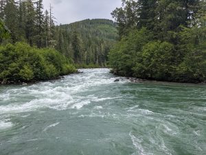
The Mountain Loop Highway running through Mount Baker-Snoqualmie National Forest makes for an easy day trip from anywhere in Snohomish County. Hike trails through the national forest, drive up to local historical sites or dip your toes in the South Fork Stillaguamish or Sauk River on a sweltering summer day.
The Mount Baker-Snoqualmie National Forest is the most-visited national forest in the United States, encompassing more than 1.7 million acres of land in the western Cascade Mountain Range. This national forest runs from the US-Canada border south to Mount Rainier National Park for a span of 140 miles.
In 1897, the Washington Forest Reserve was founded in order to preserve nearly 3.6 million acres of forest, including the area that became Washington National Forest in 1907. On January 21, 1924, President Calvin Coolidge issued an executive order that renamed part of the Washington National Forest to Mount Baker National Forest. Snoqualmie National Forest was created from another portion of that former national forest and was combined with a section of Rainier National Forest in 1933. In 1974, the Mount Baker and Snoqualmie forests were combined by an administrative action of the federal government into the Mount Baker-Snoqualmie National Forest as we know it today.
Snohomish County is home to the Mountain Loop Highway, a 55-mile stretch of road running through Mount Baker-Snoqualmie National Forest. The Mountain Loop is a paved two-lane road from Darrington to White Chuck River Road from the northern entrance, then switches to an unpaved single-lane gravel road for 13 miles. At Barlow Pass near Big Four Mountain, the pavement and two-lane road resume.
During the winter, portions of the Mountain Loop are closed to cars but are still explorable via skis or snowshoes. The ability to drive the entire loop is limited to the warmer months due to snow accumulation and the need for road crews to clear fallen trees from winter storms. Be sure to check road conditions and closures before you head out on the Mountain Loop, as the entire loop is typically not drivable until June or sometimes July.
Recreation passes or parking permits are required at some of the stops along the Mountain Loop. Although the ranger stations in Darrington and Verlot typically sell passes and permits, COVID-19 restrictions are still in effect. Visitors should make their purchases online in advance of their journey on the loop. While most of the forested trails on the Mountain Loop were designed for hikers, some of the trails are accessible for visitors of all abilities. A complete list of trails and their accessibility ratings are on the forest service’s website.
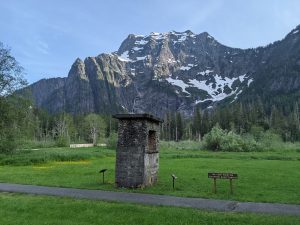
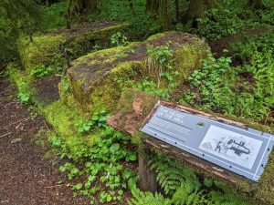
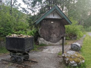
Visitors can drive right up to many of the Mountain Loop’s most scenic vistas and historic sites. Passing through Verlot, you will spy the Blackjack Creek Douglas fir. This huge crosscut section of a 700-year-old Douglas fir sits alongside some fascinating historical remnants from the Monte Cristo Mines. This stop also boasts gorgeous views of the South Fork Stillaguamish. Further down the loop, the Big Four Ice Caves, the 6,135-foot summit of Big Four Mountain, and the historical site of the former Big Four Inn are viewed up-close from the comfort of your car. Remnants of the Monte Cristo Railway are visible at dozens of spots along the loop, and many of the day use and camping areas on the loop are built on top of the former rail line.
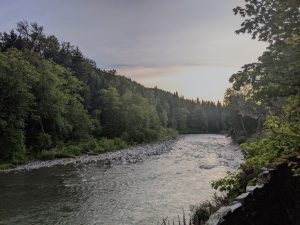
Numerous day use and picnic areas with mountain views and access to the South Fork Stillaguamish and Sauk Rivers line the Mountain Loop. Some of these areas require a recreation pass, though many do not. Visitors to the Mountain Loop can also stay overnight at any number of developed campgrounds. Reservations can be made for some of the sites in advance, and some are left as first-come/first-served sites. Dispersed camping on bare, compacted soil is also permitted on the Mountain Loop unless posted otherwise. Whether primitive camping or picnicking on the river, be sure to pack out everything you pack in and keep this national forest pristine for everyone.
The Mountain Loop Highway provides an accessible, historical, and beautiful adventure for Snohomish County residents. Whether you’re hiking, camping, or just hoping to beat the summer heat in some chilly mountain rivers, the loop running through Mount Baker Snoqualmie National Forest offers a nearby escape into the country’s most popular wilderness.


